

Otter Creek Basin, Vergennes Municipal Dock (Vermont, USA)
44.1673°N 073.2540°W
We had been thinking about visiting Vergennes for a while, it is after all the oldest city in Vermont with a reputation for hospitality towards cruisers. However, almost everyone has a story or two about going up the creek and encountering either rocks, submerged ruins or logs. We had therefore been postponing the trip upriver. That was until yesterday morning when we decided over breakfast: "Why not?" and off we went.
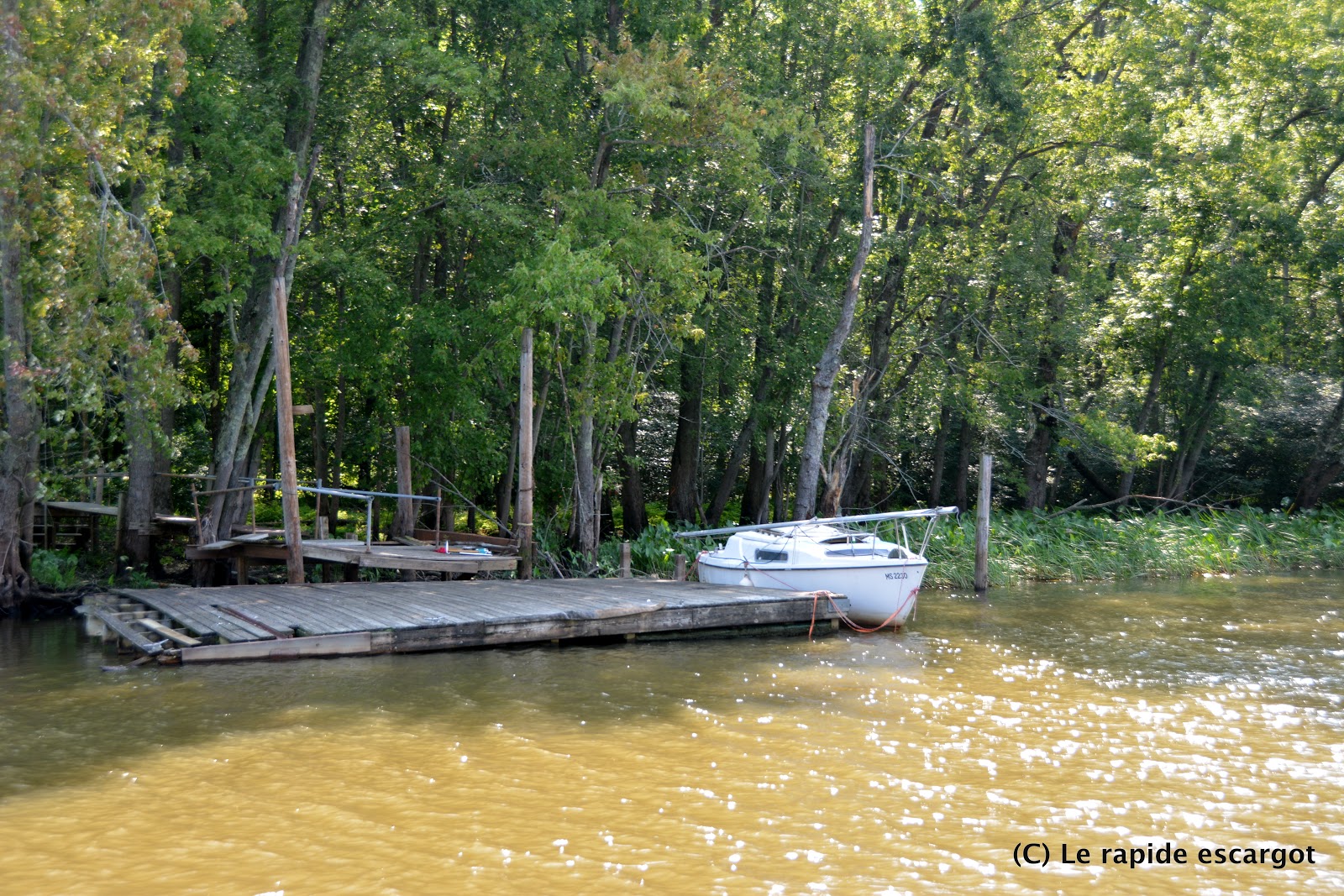
It is a 7 miles trip up Otter Creek, originally named by the French in the 17th century la Rivière aux loutres. There are no more of those furry creatures to be seen, but we came across quite a bit of wildlife: countless ospreys, turtles, grey herons, eastern kingbirds, swallows, multiple other birds that we're still trying to identify and even... a northern water snake. Need I say, I was extremely happy to be ON the boat and not swimming about.
With Lake Champlain at its current level of 96.2 ft, we did not see less than 9 feet all the way up the creek. We stayed clear of all reported obstructions thanks to Active Captain's members comments. However, we added a new one...
We did scrape the bottom with less than a mile to go. Coordinates are as follows: 44°09.947'N 073°16.162'W. The depth sounder did not even have time to catch the patch of gravel we went over and our shallow water alarm did not beep. M didn't even slow down but the noise was, however, unpleasant. Nothing like hearing that bottom paint getting scratched... Ok, ok it was just a rumbling but my mind heard the paint chipping away and added it to our to-do list for the fall. We draw 5'2" so we estimated the patch to be just under 5 feet deep.
We went back the next day with the dinghy to figure out a safe way back and found about 6 feet in the area we touched. We must have unwillingly found the high point. About 20-30 ft to the southeast, we measured no less than 10 feet of water. We haven't invested yet in a portable depth sounder but our home-made lead and line did a very good job as we picked a GPS mark, measured it with our very hi-tech instrument to be a little over 10 feet, and took the boat over it later in the day see 10.2 ft on the sounder. Funny to think some French soldier must have done the same thing back in 1690!
We did record our GPS track going up, so I will try adding some screen shots of the most critical points to this post in the coming days.
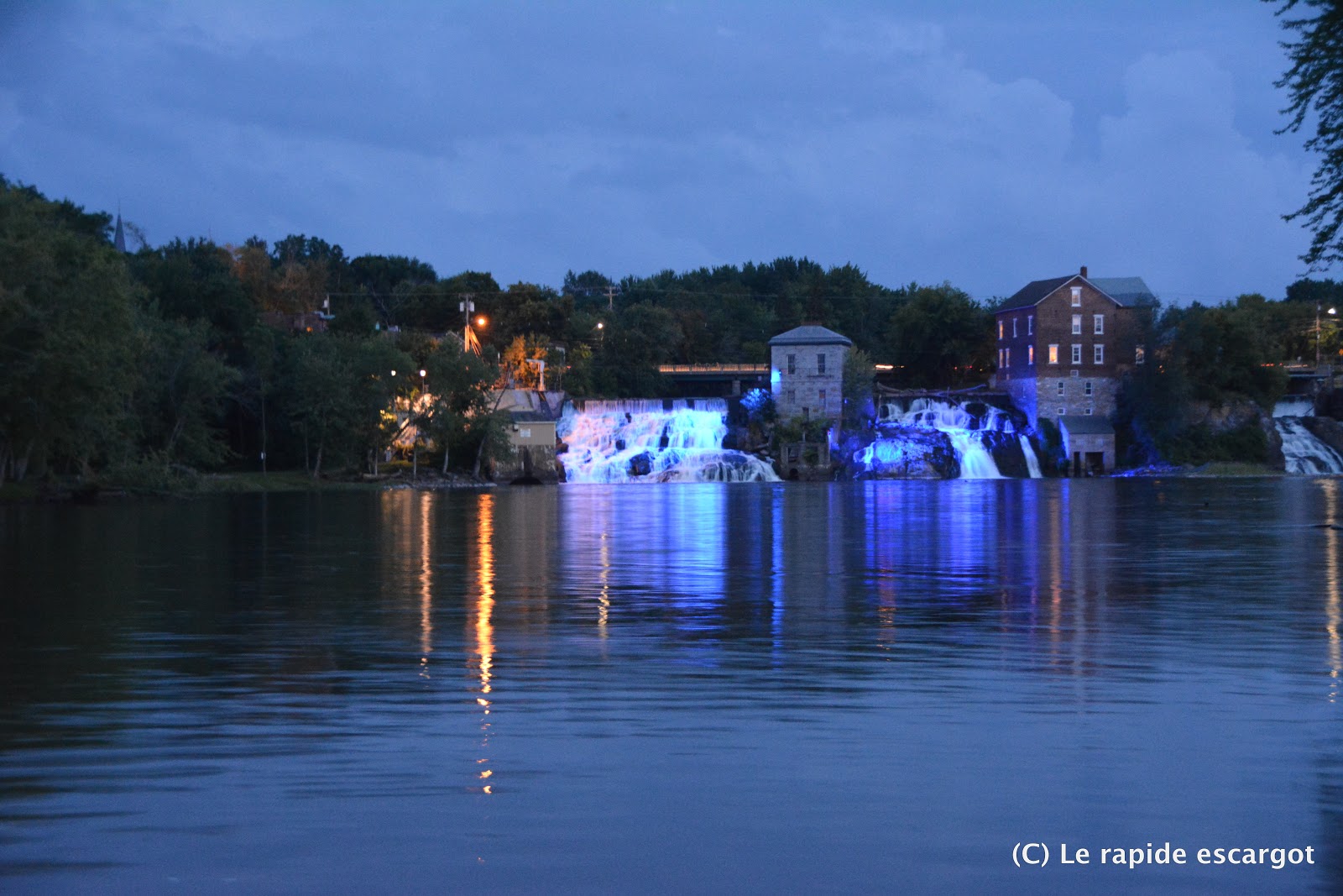
The Municipal Dock located at the bottom of the falls can accommodate up to eight 40-foot boats. There is power, water and trash containers. We got there around lunch time and the docks were empty. That was a very good thing as we got to pick a spot on the dock with 7 feet of water. The further in you go on the North dock, the less water there seems to be. Up the hill is a convenience store and gas station. For a more substantial grocery store it is a short walk to Shaw's supermarket, located 1.2 mile away. You get to cross the village and all the historical buildings which makes it a very nice provisioning trip. Another nice touch: there is a sidewalk all the way to the shopping center, which is a rare thing in most places we've visited with the boat in the US. We found the staff to be extremely friendly at the cash register. There is also a bakery on Main Street that everyone talks about, but we found them to be closed on a Tuesday as were other boutiques and art galleries.
Will we be back? Who knows. The amount of fallen trees along the way would make me avoid the creek at all cost after a strong rainfall or early in the season. However, going up creeks does have its charm and we really do like it. The place reminded us vaguely of the Dismal Swamp Canal and Pasquotank River and it was a nice flashback.


No comments:
Post a Comment